
The image above shows a regional map of Bulgaria.
|
|
SurroundingsBordering Countries: Greece, the Republic of Macedonia, Romania, Serbia, and Turkey
Bodies of Water: Black Sea Total Distance of All Land Boundaries: 1,806 km Total Distance of Coastline: 350 km |
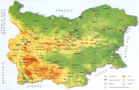
The image above shows a Bulgaria specific map.
|
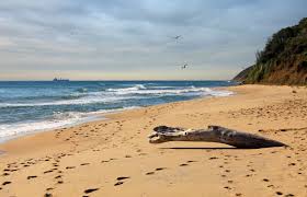
This image shows the coast of Bulgaria and the Black Sea, the lowest point of elevation.
|
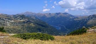
This image shows Mount Musala, the highest point of elevation.
|
|
