
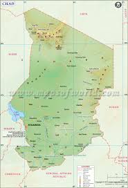
The image above shows a regional map of Chad.
|
|
SurroundingsBordering Countries: Cameroon, Central African Republic, Niger, Nigeria, and the Sudan
Bordering Bodies of Water: None Total Distance of All Land Boundaries: 6,406 km Total Distance of Coastline: 0 km |
The image above shows a Chad specific map.
|
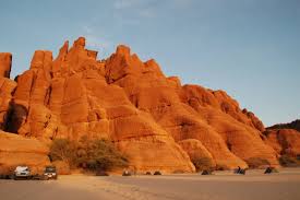
This image shows a part of Djourab, the lowest point of elevation.
|
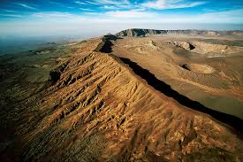
This image shows Emi Koussi, the highest point of elevation.
|
|
