
The image above shows a regional map of Luxembourg.
|
|
SurroundingsBordering Countries: Belgium, France, and Germany
Bordering Bodies of Water: None Total Distance of All Land Boundaries: 356 km Total Distance of Coastline: 0 km |
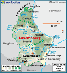
The image above shows a Luxembourg specific map.
|
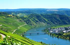
This image shows the Moselle River, the point of lowest elevation.
|
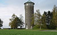
This image shows Buurgplaatz, the point of highest elevation.
|
|
